
Welcome to Paria's “Hike of the Week” series. Each week, we share one of the best backpacking routes from around the country. It's fun to daydream about your next hiking adventure. But we hope these posts motivate you to get out there and see these trails for yourself!
This week's highlight is on the Red River Gorge in Kentucky.
Featured photo: Red River Gorge (photo by Cindy Stuntz)
Why This Hike?
Neat geological features? Check. Breathtaking views? Check. Challenging terrain? Check! These are the main draws of the Red River Gorge Geological Area in eastern Kentucky. Its biggest highlights, though, are sandstone arches and cliffs. In fact, there are over 100 natural arches in the area! This is one of the highest concentrations of its kind in the eastern U.S.
As you can imagine, there are plenty of trails in the area. You could always set up base camp at Koomer Ridge Campground and do day hikes in different areas each day. Or, you can use the long-distance Sheltowee Trace Trail as a convenient connecting path from one area of the park to the other. We've come up with a route that gives you the most bang for your buck.
- Distance: 22 miles
- Type: Point-to-point
- Difficulty: Moderate to challenging
- Elevation range: 692 feet to 1,288 feet
- Best time to visit: Spring-Fall (Winter isn't advised. Rain, snow, and ice can make already dangerous areas even worse.)
- With so many arches, some are easier to get to than others. Fortunately, there are several obvious ones along this route.
- There are lots of YouTube videos on how to find the more remote arches in the park. This is fun if you have extra time, enjoy bushwhacking, and have excellent navigational skills.
- We've highlighted several (optional) side trails to some arches and lookout points. Most are very short, adding less than a mile (each) to your trip. They are very worth the effort if you like nice views and cool rock formations. Keep in mind that some of the spurs are easier than others.
- Highlights of this route include Gray's Arch, Hidden Arch, Cloud Splitter, Indian Staircase, Hanson's Point, and Adena Arch.
- You'll pass over several creeks, so filtering water shouldn't be a problem.
Before you pack your bags, keep the following in mind:
- Some arches and lookouts require rock scrambles to get to. These are probably best done without a heavy pack. Also, they are even more treacherous when wet.
How Do I Get There?
If you will be flying in, Louisville International is the closest major airport to Red River Gorge. From here, take the I-264 E ramp and continue 7.5 miles. Stay right to take exit 19A and merge onto I-64 E. Continue 69 miles. Keep left to stay on I-64 E for another 16.4 miles. Take exit 98 onto the Bert T Combs Mountain Parkway toward Campton. Continue 32.3 miles. Take exit 33, turning left onto KY-11 N. Then, just past the overpass, turn right onto KY-15 S. Continue 5 miles. Turn left onto Koomer Ridge Road. Keep straight to stay on it as it turns into Koomer Ridge Picnic Area Road. The road ends in the parking area. The total drive time is about 2 hours.
Map of Recommended Route
The following map outlines our recommended route. Click the "Load Interactive Map" button to load the correct map. Once loaded, you can navigate along the route and view recommended campsites.
For even more detailed mapping, including being able to print a copy for yourself, click the "Open in CalTopo" button at the top of the map once it's loaded into view.
- Day 1 - Koomer Ridge Trailhead to Campsite 1 (9 miles)
- Day 2 - Campsite 1 to Osborne Bend Loop Trailhead (13 miles)
Trail Description
Day 1 - Koomer Ridge Trailhead to Campsite 1
Start on a dirt path through dense woods. Go to the left at the split. Come to a little overlook. The trail narrows and comes to a set of stairs. Hidden Arch is at the bottom. More stairs head down. Next, you'll walk along the edge of some sandstone cliffs. Wind your way back into the thick of the forest. Continue straight onto the Koomer Ridge Trail.
Less than a mile later you will meet up with the Buck Trail. Make a left to get on it instead of continuing straight on the Koomer Ridge Trail. Head down towards Chimney Top Creek. This is a beautiful, serene setting. It's also a good spot to fill up on water. After this short break, head right back up to Pinch Em Tight Ridge. Connect with the Sheltowee Trace Trail and head left on it. Fortunately, this section mostly follows a ridgeline before connecting to the Gray's Arch Trail.
The single track continues through the forest with a short open area. Then you hike mostly along the ridgeline again. You'll get some decent views here in shoulder seasons. Get a glimpse of Gray's Arch from the trail through the mix of trees before walking down to it. Continuing, make a right onto the Rough Trail.
Not surprisingly, this trail is named so for a reason. Get ready for lots of ups and downs. Get a break descending into the valley. Cross another seasonal creek and King Branch shortly after. You'll come to a couple of short side trails before long. They are worth exploring if you have the time. Head down and across Rush Branch before ascending again to the Hanson's Point Trail. The views along this trail are amazing. Round-trip, it adds on about 2.3 miles.
Past here, the trail intersects with the Sheltowee Trace Trail. Walk along the ridge before making a steep descent to the valley. Cross Chimney Top Creek twice before heading north. Continue on the Sheltowee Trace Trail as it wanders next to the creek. Enjoy the “cooldown” of this gloriously flat section before reaching your campsite next to the creek.
Day 2 - Campsite 1 to Osborne Bend Loop Trailhead
The trail stays relatively even until you cross over the Red River. Cross KY 715 and head up. The trail travels just below the ridgelines. Rock formations keep you intrigued enough to take your mind off the climb. The trail has a lot more twists and turns as it makes its way toward the spur to Cloud Splitter. This side trail is super short. So, you might as well billy goat your way up for the excellent views.
Past here is another nice lookout point. A huge rock overhang will make you feel as small as an ant. Don't miss the side trail to Adena Arch. It's only about an extra mile, round-trip. Shortly after is the climb up to Indian Staircase. It's short, but steep. Again, the views are totally worth it.
Continue along the Sheltowee Trace, heading mostly back down before reaching Klaber Branch. You can stock up on water here. Climb up some again, passing a few seasonal streams along the way. Shortly after passing Salt Fork, continue straight onto the Lost Branch Trail. You'll travel near Gladie Creek for a bit before ascending once again. It's very rocky here, following an old road.
The trail calms down for a while, hiking along the top of a rounded mountain. You have two options when you reach the Osborne Bend Loop Trail. Turn right to cut your trip shorter. Head left for some extra mileage.
You'll enjoy this section for its solitude. It's much less traveled than other nearby trails. (You're also technically in Clifty Wilderness now.) It's just a nice, quiet forest loop without any crazy ups and downs. It's a nice way to wind your trip down, literally and physically. Plus, if you found you spent too much time at the sights, there are some nice camping areas along this section. (All of today's spur trails add about 1.6 miles.) You'll know you're getting close to the parking area when you find, unfortunately, a bunch of graffiti on the rock features.
What Will I Need?
The average highs for March through December are around 45 to 85°F. The average lows are between 32 and 65°F. Fall is usually the driest of these seasons. Plus, the temperatures become favorable again. That said, a versatile down quilt works great for this trip. (Plus your sleeping pad, of course.) For warmer months, a mesh bivvy or tent and tarp will help keep you cool at night. Lightweight backpacking tents work any time of year too.
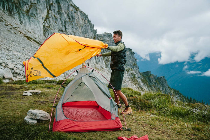
Our Bryce 1P backpacking tent is lightweight and weatherproof, making it a great option for the rugged Red River Gorge.
With all of the elevation changes, you might want to bring the trekking poles along. Hiking shoes or boots with good tread are also a must for rocky surfaces.
No matter what you're making your meals on, don't forget you're cooking pot. Long-handled sporks make an easier time of eating pre-packaged trail meals.
If there's anything else you need to complete your pack, visit our full line of high-quality, affordable backpacking gear.
Shop Backpacking Tents
Shop Ultralight Tarps
Shop Backpacking Quilts
Shop Down Sleeping Bags
Shop Insulated Sleeping Pads
Shop Backpacking Pillow
Shop Folding Trekking Poles
Shop Titanium Cookware
Shop Tent and Tarp Accessories
Finally, to make sure you don't forget something at home, use our Ultimate Backpacker's Packing List. It even includes a convenient printable checklist!
Do I Need a Permit?
For backpacking, you will need a recreation permit to display in your vehicle for overnight parking. These are $5 per day or $7 for 3 days.
Resources
Conclusion
If you're looking for a challenging hike that gives you some of the most scenic views in the Midwest, don't pass up a trip to Red River Gorge. What are your favorite trails in this area? We'd love to hear about them in the comments section below!
Read Next
If you're looking for more hike ideas, read our “Best Backpacking Trips in the Midwest” round-up post. Also, the following Hike of the Week articles cover other great trails in the region.
Hike of the Week: Shawnee Backpacking Loop
Hike of the Week: Triple Crown Loop
Hike of the Week: Pennsylvania Grand Canyon West Rim Trail
For even more amazing backpacking trips visit The Trailhead, our interactive hike map. It contains a curated list of dozens of hikes, each with a detailed write-up like this one.

Finally, check out our comprehensive list of backpacking articles that cover just about everything there is to know about backpacking. If you're just starting out, our Backpacking 101 section covers all the basics. If you already have a few trips under your belt, you can find more advanced topics covered in our Expert Articles.


Leave a comment