
Welcome to Paria's “Hike of the Week” series. These articles highlight one of the best trails from around the country. In this series, we hope to inspire you to get out there and see these places for yourselves. Pictures are great, but nothing beats hiking a trail in person!
This week's spotlight is on the Pine Mountain Trail in Georgia.
Featured Photo: Neal Wellons
Why This Trail?
The Pine Mountain Trail is located in FD Roosevelt State Park in western Georgia. This area has some unique topography. It is the tallest point for miles around, with flatlands on either side. The trail runs right along the ridgeline. This offers great views in late fall through early spring. With the temperate weather of Georgia, it's a great choice for a winter hike.
- Length: 23 Miles
- Difficulty: Intermediate
- Type: Point-to-Point
- Total Elevation Gain: 3,250 feet
- Best Time to Visit: Spring and Fall
- The trail is open year-round, but summer can be very humid. Plus, you don't get the ridgetop views you do in other seasons.
- This is a great trail if you're new to backpacking. It's also a great place to train for adding more days/miles to your trips. There are many access points if you need to bail. Plus, while there are some rises, there are no extreme inclines.
- There are many connecting trails, so you could add on some loops to lengthen your trip.
- The trail features several small waterfalls, a lookout point, mixed forest, and rocky outcroppings.
- The trail is easy to follow and well-maintained.
- Plenty of designated campsites are located along the route.
- There is a store at the end of the trail and a good BBQ place in town. Who doesn't love a good meal at the end of a backpacking trip?
Before you pack your bags, keep the following in mind:
- You need to decide what campsite(s) you would like to stay at before paying for your permits at the park office/ranger station.
- Much of the trail is root-covered and rocky.
- You will need to arrange for a shuttle or spot a car. There are currently no shuttle services available in the area.
How Do I Get There?
The closest major airfield is Hartsfield-Jackson International Airport in Atlanta, Georgia. From here, turn right onto I-85 S ramp. Follow signs and stay to the right. Continue on I-85 S for 29.4 miles. Take exit 41 toward Moreland/Greenville. Turn left onto US-29 S and continue 21.2 miles. Follow signs to keep on US-29 S. After continuing for about 5 miles past the traffic circle, make a slight left onto Juke Line Road. A little under a mile later, make another slight left onto US-27 ALT S. Continue a half-mile and turn right onto US-27 ALT S/Whitehouse Pkwy. Continue 3.3 miles. Your destination will be on your right. The total distance is 66 miles and around 1 hour and 10 minutes drive time.
The following map outlines our recommended route. Click the "Load Interactive Map" button to load the correct map. Once loaded, you can navigate along the route and view recommended camp sites.
For even more detailed mapping, including being able to print a copy for yourself, click the "Open in CalTopo" button at the top of the map once it's loaded into view.
Map of Recommended Route
- Day 1 - Eastern Trailhead to Sparks Creek Campsite (6 miles)
- Day 2 - Sparks Creek Campsite to Turtle Hollow Campsite (9 miles)
- Day 3 - Turtle Hollow Campsite to Western Trailhead (8 miles)
Trail Description
Day 1 - Eastern Trailhead to Sparks Creek Campsite
Your first day starts on a nice level walk. You'll pass by a slew of waterfalls, starting with Csonka and ending with the larger Cascade Falls. These are all within the first 3 miles of the trail. Eventually, you'll start ascending Hogback Mountain. It will get your heart rate up, but isn't intense. There are some interesting rocky outcroppings along here too.
Cross the Pine Mountain Highway around mile marker 18. About a mile later you'll reach your campsite for the night. The Sparks Creek camping area is nice and flat. Plus, you'll love it if you like staying at camp sites close to water access. It's within sight of its namesake creek.
Day 2 - Sparks Creek Campsite to Turtle Hollow Campsite
Your second day starts with some beautiful ridgeline views. (If you're visiting outside of summer.) You'll go up and down some more gentle inclines before reaching Dowdell's Knob. This is the highest point along the trail and a scenic place to take a break. Shortly after, you'll come across the plane crash memorial. Then, a little way down from that, you'll pass by a small boulder known as Elephant Rock.
The great views will continue for a mile or two before returning to the thick of the woods. But, the views open up yet again after crossing the road once more as you near mile marker 12. You'll cross the highway again shortly before mile 11. The rest of your journey to Turtle Hollow campsite travels through the mixed forest. Careful where you step as there are some rocky sections along here. Turtle Hollow is further off the main trail than many others. This makes it a great spot for some seclusion.
Day 3 - Turtle Hollow Campsite to Western Trailhead
Your last day starts by climbing back up the hill to the main trail. If you're there in leaf-less seasons, you'll have some views through the trees, but not like the day before. Take care with your footing over the rocky ledges near Fox Den Cove. Traverse up and down more gentle slopes through the trees. Soon you'll reach another road crossing. The trail goes up near the park office, offering more spectacular views before you reach the end of your journey. The view from Buzzard Roost is especially awesome.
What Will I Need?
Average highs for March through May range between 69 and 82°F, lows between 41 and 57°F. Temperatures are similar for September through November. A versatile down quilt or sleeping bag will serve you well for either season. If you plan on using trekking poles, a trekking pole tent is an obvious choice for a shelter. Otherwise, a lightweight backpacking tent works just as well.
An ultralight sleeping pad will save on pack weight. If you feel like having some extra comfort, down camping pillows weigh next to nothing and pack down small.
Whether you have a site with a fire ring or not, you'll need something to boil water/cook food in. Titanium cooking pots are lightweight and can double as a mug.
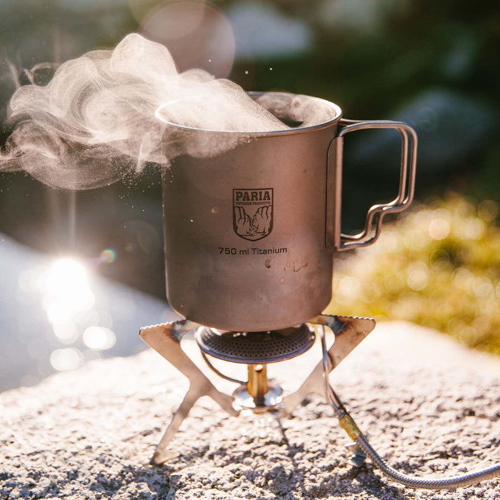
Titanium cooking pots are great for backpacking. They're ultralight, but extremely durable.
If there's anything else you need to complete your pack, visit our full line of high-quality, affordable backpacking gear.
Shop Backpacking Tents
Shop Ultralight Tarps
Shop Backpacking Quilts
Shop Down Sleeping Bags
Shop Insulated Sleeping Pads
Shop Backpacking Pillow
Shop Folding Trekking Poles
Shop Titanium Cookware
Shop Tent and Tarp Accessories
Finally, to make sure you don't forget something at home, use our Ultimate Backpacker's Packing List. It even includes a convenient printable checklist!
Do I Need a Permit?
Yes. You will need to secure permits at the park office. These are $10/night. You will also need to get a parking pass for the number of days you plan on staying in the park. These are $5/day. You can find more information on both of these here.
Resources
Pine Mountain Trail Association
Franklin Delano Roosevelt State Park
Conclusion
If you're looking for a laid back trip in the western woods of Georgia, you can't beat the Pine Mountain Trail. Have you completed this trail or any others at FD Roosevelt State Park? We'd love to hear about your experience in the comments below!
Read Next
If you're looking for more hike ideas, read our "Best Backpacking Trips in the Eastern U.S." round-up post. Also, the following Hike of the Week articles cover other great trails in the region.
Hike of the Week: Bartram Trail-Georgia Section
Hike of the Week: Art Loeb Trail
Hike of the Week: North Sterling Loop
For even more amazing backpacking trips, visit The Trailhead, our interactive hike map. It contains a curated list of dozens of hikes, each with a detailed write-up like this one.

Finally, check out our comprehensive list of backpacking articles that cover just about everything there is to know about backpacking. If you're just starting out, our Backpacking 101 section covers all the basics. If you already have a few trips under your belt, you can find more advanced topics covered in our Expert Articles.


Leave a comment