
Welcome to Paria's “Hike of the Week” series. Each week, we highlight one of the best trails from around the country. We hope reading about these inspires you to get out and see them for yourself!
This week we're featuring the Pictured Rocks Lakeshore Trail in Michigan's Upper Peninsula.
Featured Photo: Twelvemile Beach (photo by Jim Rhodes)
Why Hike the Pictured Rocks Lakeshore Trail?
There are many beautiful places in Michigan's UP. Rugged lakeshores, unique geological features, and dense forests mark the region. Pictured Rocks National Lakeshore is one of the most popular places to visit here. Arguably, it offers some of the most unique scenery the UP offers. The Pictured Rocks Lakeshore Trail is your best option for an extended stay. This 40 miles never ventures farther than a mile inland. It runs between Munising and Grand Marais and is part of the much longer North Country Trail.
- Length: 42 miles
- Type: Point-to-point
- Difficulty: Moderate
- Elevation gain: 2,000ft
- Best time to visit: May-October
- Highlights: Waterfalls, rivers, sand dunes, dense boreal forests, plunging cliffs into Lake Superior (with spectacular views), white sand beaches, beautiful blue-green inlets, one-of-a-kind geological features, Little Beaver Lake, Au Sable Light Station, Grand Sable Dunes, Grand Sable Banks (actually glacial deposits), Grand Sable Lake, Masse Homestead, Spray Falls, Twelvemile Beach
- Take a side trip to Sable Falls at the end.
- There are plenty of campsites along the route. Most are only several miles apart, including group camps.
- Primitive toilets are found at some of the camping areas.
- You'll find plenty of water sources along the trail. Streams and occasional access to the largest freshwater lake in the world make this possible.
Before you pack your bags, keep the following in mind:
- June is bad for flies.
- Beach camping is prohibited.
- Black bears are no strangers here. There are special bear-proof lockers to keep your “smelly” items in at night. Other wildlife includes grey wolves, snowshoe hares, deer, bald eagles, and osprey.
- The trail is not very well-marked.
- Be careful and do not get near cliff edges. They can crumble beneath you!
How Do I Get There?
One direction is not really better than the other for this trail. We have decided to describe the route starting at the Munising Falls Visitor Center at the west end. Sawyer International Airport is the closest major terminal. From here, take Ave B and 5th St to M-94 E. Continue 7.3 miles before turning right onto US-41 S. Turn left onto M-94 E again a mile later. Continue 14 miles. Make another short jog on Rock River Road (turning right) before turning left back onto M-94 E. Continue another 15.5 miles. Turn left onto M-28 W, continuing a little over a mile. Exit onto E Munising Ave at the traffic circle. After 1.3 miles, turn left onto Washington Street. Continue until you reach the parking lot of the visitor center.
Map of Recommended Route
The following map outlines our recommended route. Click the "Load Interactive Map" button to load the correct map. Once loaded, you can navigate along the route and view recommended campsites.
For even more detailed mapping, including being able to print a copy for yourself, click the "Open in CalTopo" button at the top of the map once it's loaded into view.
- Day 1 - Munising Falls Visitor Center to Chapel Beach (15.5 miles)
- Day 2 - Chapel Beach to Benchmark (14 miles)
- Day 3 - Benchmark to Grand Sable Visitor Center (12 miles)
Trail Description
Day 1 - Munising Falls Visitor Center to Chapel Beach
Start on a gradual climb through thick woods. You'll pass by several small cascades. You'll reach the top of the escarpment after the first few miles. Sadly, the forest is still dense here, which means the views of Lake Superior won't be great. By this point, you have hiked by several campgrounds. Soon you will come to the Miners Castle Overlook trail. This is a very neat rock formation jutting out into the lake. So, make sure you take advantage of that.
You'll get some good views of the lake after crossing Miners River and near its beach. Head up and down once more, passing by Mosquito River campground. The section of trail after this is the most popular. It features the best views of Lake Superior and rock formations such as Arch Rock and Indian Head Point. Take care on the steep trail here. Finally, you will reach Chapel Beach and your resting spot for the night.
Day 2 - Chapel Beach to Benchmark
Start your day off with yet another cool rock formation. (Chapel Rock) Climb the stairs and soon reach Spray Falls. Keep your eyes open for this lookout. The falls plunge 70 feet right into the lake and are worth the look. Continuing, hike through the beautiful Coves area. Or, you can opt to walk along the beach. Following any stream will take you back to the trail.
Pass by a couple of campgrounds near Sevenmile Creek if you stay on the trail. Meander in and out of the forest on your way to Twelvemile Beach. There are some great views along this section of the beach and lake. Pass by quite a few campgrounds and parking for a day-use area. Shortly after you'll reach Benchmark, your campsite for the night.
Day 3 - Benchmark to Grand Sable Visitor Center
You'll start the last day with several Highway 58 crossings. Pass by the Hurricane River Campground and picnic area. About a mile and a half later you will come across the Au Sable Light Station. If you visit during the summer, stop in the lighthouse for a tour. Walk down to the beach to check out old shipwreck remnants.
After your pit stop, head uphill through the Log Slide area. Soon you will be walking along the Grand Sable Dunes. If you have some time, take the side trail to the Masse Homestead. If not, continue inland, passing by Grand Sable Lake. This is a great spot to take a break. Follow Highway 58 for a bit before shortly continuing on the Lakeshore/North Country Trail. The last bit is wooded before opening up to an old apple orchard and the Grand Sable Visitor Center.
What Will I Need?
Average highs between May and October are 55-75°F. Average lows are 39-56°F. A versatile down quilt will keep you warm at night. A quality sleeping pad helps even more. With plenty of trees, hammock camping is a possibility. (Don't forget your tarp for rainy nights.) Prefer more protection? A durable, lightweight backpacking tent is perfect.
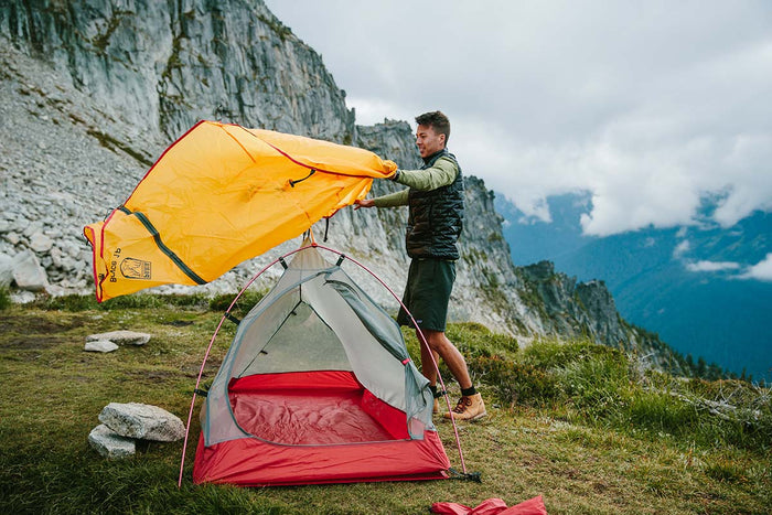
Our Bryce 1P backpacking tent is lightweight and weatherproof, making it a great option for the finicky weather of Lake Superior.
Since the terrain isn't terribly grueling, splurge and bring an inflatable sit pad for hanging out. Down pillows feel luxurious at night too. They're very lightweight and take up little room.
Titanium cooking pots are also light and last forever. Don't forget your long-handled spork too. These are great for those messy freeze-dried meals!
If there's anything else you need to complete your pack, visit our full line of high-quality, affordable backpacking gear.
Shop Backpacking Tents
Shop Ultralight Tarps
Shop Backpacking Quilts
Shop Down Sleeping Bags
Shop Insulated Sleeping Pads
Shop Backpacking Pillow
Shop Folding Trekking Poles
Shop Titanium Cookware
Shop Tent and Tarp Accessories
Finally, to make sure you don't forget something at home, use our Ultimate Backpacker's Packing List. It even includes a convenient printable checklist!
Do I Need a Permit?
Yes, you will need a backcountry permit. These can be reserved through recreation.gov. There is a reservation fee of $15. You will also pay a user fee of $5/person per night. No changes can be made to these after they're printed, so be sure of your plans!
Resources
Permit and Reservation Information
Backpacking Shuttle Service
Conclusion
If you're looking to see the best of Pictured Rocks National Lakeshore, the Lakeshore Trail is your best option. Have you completed this or any other sections of the North Country Trail? We'd love to hear about your trip in the comments section below!
Read Next
If you're looking for more hike ideas, read our "Best Backpacking Trips in the Midwest" round-up post. Also, the following Hike of the Week articles cover other great trails in the region.
Hike of the Week: Isle Royale National Park
Hike of the Week: Superior Hiking Trail-Section 6
Hike of the Week: Newport State Park
For even more amazing backpacking trips, visit The Trailhead, our interactive hike map. It contains a curated list of dozens of hikes, each with a detailed write-up like this one.

Finally, check out our comprehensive list of backpacking articles that cover just about everything there is to know about backpacking. If you're just starting out, our Backpacking 101 section covers all the basics. If you already have a few trips under your belt, you can find more advanced topics covered in our Expert Articles.


Leave a comment