
Welcome to Paria's “Hike of the Week” series. These articles highlight the best backpacking trails from around the U.S. Reading about an epic trail is enough to get us inspired to want to see it for ourselves. That said, we hope this series does the same for you!
This week we're highlighting the McKittrick Ridge Trail in Texas.
Featured Photo: McKittrick Canyon (photo by Patrick Alexander)
Why This Hike?
Mountains? In Texas?! That is just what you'll find in Guadalupe Mountains National Park. When most people think of backpacking in The Lonestar State, they think of Big Bend NP. Other than that, Texas doesn't get much love when it comes to hiking. That makes this hike somewhat of a hidden gem.
The Guadalupe Mountains NP boasts peaks of over 7,000 feet tall. It also features a surprisingly diverse array of terrain, ranging from desert to forest, meadow to canyon. And, because this hike starts at the base of a canyon, you're sure to get a good workout climbing to the top of McKittrick Ridge!
- Distance: 14 miles
- Type: Out-and-back
- Difficulty: Strenuous
- Elevation gain: 2,700 feet
- Best time to visit: March-October; Go in the spring for the wildflowers, fall for the beautiful colors.
- Guadalupe Peak, which you'll hike along the bottom of, is the highest point in Texas.
- Several highlights along the way include:
-Pratt Cabin, which belonged to the man who donated the land for the park
-The Grotto-A small cave hidden in the rocks and
-Hunter Line Cabin, which is located close to the Grotto - Your troubles are rewarded with better and better views as you climb higher and higher.
- Wildlife you might see: mule deer, mountain lions, black bears, horned lizards, and hummingbirds
- There is a convenient restroom and water spigot at the trailhead.
- Alternate route: Start in Dog Canyon. This way is less steep than the one we're covering in this post, but still a workout.
Before you pack your bags, keep the following in mind:
- There are no water sources along this trail. (Aside from a stream near the trailhead.) Be sure to pack all that you need for two days of hiking!
- Dogs are not allowed on the trail.
- It can get quite windy here. Just something to keep in mind the higher you get.
How Do I Get There?
El Paso International is the closest major airport to Guadalupe Mountains NP. From here, turn left onto US-180E. Continue for 110 miles. Turn left on McKittrick Rd. Drive 4.3 miles. The road ends in the parking area. Total drive time is about 2 hours.
Map of Recommended Route
The following map outlines our recommended route. Click the "Load Interactive Map" button to load the correct map. Once loaded, you can navigate along the route and view recommended campsites.
For even more detailed mapping, including being able to print a copy for yourself, click the "Open in CalTopo" button at the top of the map once it's loaded into view.
- Day 1 - McKittrick Canyon Trailhead to McKittrick Ridge Camp (7 miles)
- Day 2 - McKittrick Ridge Camp to McKittrick Canyon Trailhead (7 miles)
*It is worth noting that some hikers have reported distances closer to 9 miles out.
Trail Description
Day 1 - McKittrick Canyon Trailhead to McKittrick Ridge Camp
Start with some easy, flat hiking past a dry creek bed. It's very exposed as the wide gravel path winds through the brushy desertland. The valley is surprisingly lush against the backdrop of the towering mountains. Come to the stream about a mile in. Between miles 2 and 3 is the short side trail to Pratt Cabin. This is a nice place to take a break in the shade (and chairs) of the porch. The gorgeous stone building blends seamlessly with the surrounding rocky landscape.
There is a little incline past mile 3 as you head towards the Grotta. This area is not far from the main trail. It's worth a stop if you enjoy unique rock formations. They look like a cross between traditional underground cave formations and coral from an ancient sea bed. If you listen closely, you can hear water dripping inside the alcove. If you haven't taken a break yet, take advantage of the tables set up nearby. If you feel like it, you can find the Hunter Line Cabin nearby too.
The real fun begins right after the Grotto. Unlike the bottomlands, shade is sporadic up here. You'll likely want to take advantage of it whenever you can. (Don't forget your hat and/or sunscreen!) The views become amazing just a mile into your climb. The nice vistas look down into the canyon dotted with yucca, small cacti, and ponderosa pines.
You will find some glorious shade about 4-5 miles in under some trees and the shadow of the rock walls lining the trail. Take care with your footing. It also gets rocky and precipitous through here. Don't forget to take time to enjoy the breathtaking surroundings, though. You'll find more incredible, open views of the canyon where you just came from.
The rocks on the trail seem to get larger the steeper the climb gets. By mile 5 you're pretty well into the switchbacks. The rocks get bad enough at one point that steps have been chiseled into them.
The last two miles are the most strenuous. Somehow, the trail climbs even sharper and is still quite rocky. The switchbacks get shorter and shorter as you approach the area known as The Notch. (About 6 miles in.) This beautiful overlook is a great place to rest. The trail calms down a little past here. But, there are some false summits too, for good measure.
You'll walk along a narrow ridge to get to the mountain you'll be camping on. The views from here are great on both sides. Finally find some shade under the trees on the other side. This area is where most hikers consider the third false summit. While discouraging, take this as a good sign that you really are close now!
You'll find several established campsites under the pines at McKittrick Ridge Camp. The views from here aren't quite as good as the ones from the trail. But, the shelter of the trees will be a welcome sight!
Day 2 - McKittrick Ridge Camp to McKittrick Canyon Trailhead
Pack up and head back the way you came! And don't forget to take advantage of that spigot at the trailhead.
What Do I Need?
Average highs and lows stay fairly reasonable in the Guadalupe Mountains. Highs range between 54 and 78°F, lows 30-54°F from March to October. A solid down quilt will keep you warm and toasty at night. You need a high-quality sleeping pad too to help insulate you from the ground. For your shelter, we recommend a lightweight backpacking tent to keep you from being bogged down on that steep ascent.
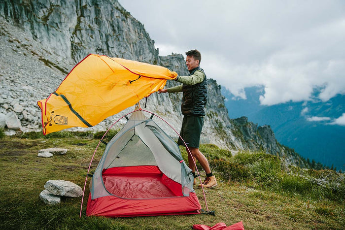
Our Bryce 1P backpacking tent is lightweight and weatherproof, making it a great option to save some pack weight on the McKittrick Ridge Trail.
Speaking of that climb, some trekking poles will probably be your new best friend on this trail. A lightweight, inflatable sit pad can make your breaks more comfortable too.
There is a lot of loose gravel and rocks of all sizes on this route. You might consider a pair of gaiters to keep them from sneaking inside of your footwear.
Again, there are no water sources except the creek near the trailhead. Be sure to take an extra-large water bladder. It's recommended to carry as much water as you can!
If there's anything else you need to complete your pack, visit our full line of high-quality, affordable backpacking gear.
Shop Backpacking Tents
Shop Ultralight Tarps
Shop Backpacking Quilts
Shop Down Sleeping Bags
Shop Insulated Sleeping Pads
Shop Backpacking Pillow
Shop Folding Trekking Poles
Shop Titanium Cookware
Shop Tent and Tarp Accessories
Finally, to make sure you don't forget something at home, use our Ultimate Backpacker's Packing List. It even includes a convenient printable checklist!
Do I Need a Permit?
Yes. You will need to get a wilderness use permit from the Pine Springs Visitor Center. This includes a $6 reservation fee and a $6 per person/night recreation fee. As of summer 2022, you can also get your permits online. (See below.) You will also have to pay a $10 entrance fee to get into the park.
Resources
Wilderness Use Permits
NPS Page-Info and Alerts
Conclusion
Looking for a short, but challenging, overnight in some of Texas' most interesting land? Don't pass up a chance to check out the McKittrick Ridge Trail!
Have you completed this hike or any others in western Texas? We'd love to hear about your experience in the comments below!
Read Next
If you're looking for more hike ideas, read our “Best Backpacking Trips in the Desert Southwest” round-up post. Also, the following Hike of the Week articles cover other great trails in the region.
Hike of the Week: White Rock Springs in the Superstition Mountains
Hike of the Week: Outer Mountain Loop
Hike of the Week: Buckskin Gulch/Paria Canyon
For even more amazing backpacking trips, visit The Trailhead, our interactive hike map. It contains a curated list of dozens of hikes, each with a detailed write-up like this one.

Finally, check out our comprehensive list of backpacking articles that cover just about everything there is to know about backpacking. If you're just starting out, our Backpacking 101 section covers all the basics. If you already have a few trips under your belt, you can find more advanced topics covered in our Expert Articles.


Leave a comment