
Welcome to Paria's “Hike of the Week” series. Each week, we feature a great trail from around the country. We hope to inspire you to see these trails for yourself. Pictures are great inspiration, but nothing beats seeing them in person!
This week's hike takes us to the Lake Ouachita Vista Trail in western Arkansas.
Featured Photo: Island in Lake Ouachita (photo by Granger Meador)
Why Hike the Lake Ouachita Vista Trail?
This trail is located in the scenic Ouachita National Forest. It runs along the southern shore of Lake Ouachita. (Which, by the way, is the largest lake in the state and one of the cleanest in the U.S.) Its nickname, the LOViT Trail, makes a convenient acronym. But, with all the wildlife and vistas, you're sure to love it too!
- Distance: 36 miles
- Type: Point-to-point
- Difficulty: Moderate
- Total elevation gain: 4,500 feet
- Best time to visit: Spring and fall (Each season has its perks, though.)
- There are some established campsites along the way. You can also stop in a “regular” campground for the night. (Refreshing shower, anyone?) That said, dispersed camping is allowed too.
- The route is well-taken care of by the “Traildogs”, part of the Friends of Lake Ouachita group.
- Lots of access points are available. This is convenient if you need to bail. Or, if you want/need to section hike the trail.
- There are some spur trails along the way. These are nice if you're the type that likes to extend trips.
- Vistas along the way offer views year-round. But, Arkansas has a fairly temperate climate. A trip in the winter isn't out of the question.
- Highlights include waterfalls, creeks, and stunning lake and mountain views.
Before you pack your bags, keep the following in mind:
- This trail is also a popular destination for mountain bikers. Be prepared to share the trail.
- Hunting is another popular activity in the area. Check the Arkansas Game & Fish Commission link in the “Resources” section for more info.
How Do I Get There?
Clinton National Airport in Little Rock is the closest major airport to the LOViT Trail. From there, merge onto I-440 W. 2 miles later, exit onto I-30 W. Follow the signs to stay on I-30 W and continue for 27 miles. Take exit 111 for US-70 W. Follow signs to stay on this road for 30 miles. Turn right onto State Hwy 949-3. Turn left onto Trails End Lane. Make a slight left and continue until the road ends in the parking area. The drive is about 1 ½ hours and 84 miles.
Map of Recommended Route
The following map outlines our recommended route. Click the "Load Interactive Map" button to load the correct map. Once loaded, you can navigate along the route and view recommended campsites.
For even more detailed mapping, including being able to print a copy for yourself, click the "Open in CalTopo" button at the top of the map once it's loaded into view.
- Day 1 - Denby Bay Trailhead to Irons Creek (11 miles)
- Day 2 - Irons Creek to Bear Mountain (13 miles)
- Day 3 - Bear Mountain to Avery Trailhead (12 miles)
Trail Description
Day 1 - Denby Bay Trailhead to Irons Creek
Lake views galore on your first day. The trail meanders the outskirts of the peninsula. This part of the trail is leisurely with gentle ups and downs. Take the short spur trail to Sunset Vista if you have time. Obviously, this is especially scenic if you arrive late in the day.
The scenery is quite different on the other side of this peninsula. You'll find lots of unique rock formations, including old quartz mines. You'll also find another spur to Eagle Vista. If you're into birding, it's a great place to visit during the winter.
Soon you'll find yourself in an old-growth forest as the trail winds away from the lake. You'll meander alongside Irons Creek for a few miles. Your stopping place for the night is near the second creek crossing. It's always nice to have a close source of water for cooking and filling up for the next day!
Day 2 - Irons Creek to Bear Mountain
Hopefully you are well-rested. The second day starts with an uphill climb. But before you start, take the short spur to the Cascades for a moment of zen. Shortly after you'll come across Hot Dog Falls. Then you'll start the trek up. It's fairly steep and rocky, so watch your footing. Don't let the level area fool you. A couple of sharp switchbacks await before reaching the top. The views atop the mountain's picnic area can't be beat.
You'll continue past more large rock outcroppings. You'll meander along another creek for a bit too. This one is filled with small, but beautiful, cascades. The path down the mountain is just as steep, but offers more great vistas of the lake.
Things get considerably easier as you get closer to the Pipe Spring trailhead. After that, you'll cross over a smaller mountain. The trail winds closer to the lake once again. Be sure to fill up at Little Bear Creek. There won't be anywhere else to fill up for several miles. (Much of the next day travels along the ridge of three mountains.) The climb up Little Bear Mountain is also one of the hardest parts of the trail. Luckily, you'll be setting up camp shortly after that!
Day 3 - Bear Mountain to Avery Trailhead
Enjoy the great views this area offers before heading east. The trail runs just below the summit of this small chain of mountains. The lake views here are even better in leaf-less months. This is the longest segment of the trail that does not cross a road.
The last major climb of the trail is Brady Mountain. Fortunately, it's not as severe as some of the previous mountains. You'll traverse some switchbacks on the other side before reaching a road crossing. Take one more break at the Blakely Mountain Dam Vista. Some more sharp switchbacks await you on your way down to the Avery Trailhead parking lot.
What Will I Need?
Average spring highs are a pleasant 63-79°F, lows between 37 and 55°F. Summer tends to try and hold on in the fall months. Highs range between 62 and 84°F, lows being 36-58°F.Hammock camping is a great option for this trail. Be sure to bring a tarp to protect you from rain and give you some privacy. If you prefer to stay grounded, choose a lightweight backpacking tent to save on pack weight.
You definitely won't need a subzero sleeping bag for this trip. A versatile down quilt rated for 30°F (comfort rating) should suit you fine. If you tend to sleep cold, a down sleeping bag with a lower comfort rating might work better for you. And, of course, don't forget your sleeping pad!
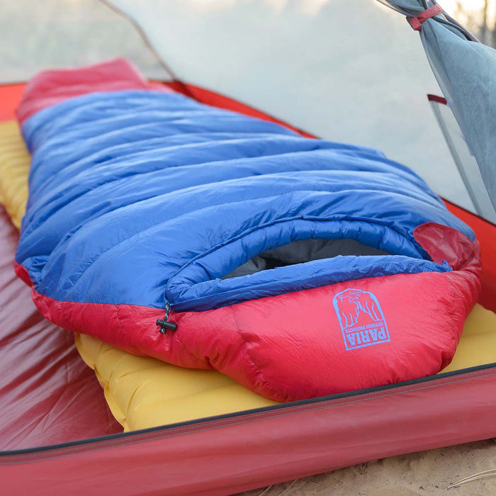
The Thermodown 15 Sleeping Bag is rated for 15 degrees, which makes it a great option for the cooler seasons on the LOViT Trail.
It can get breezy along the lake. Make sure you have a mug with you for those warm beverages in the mornings.
Some trekking poles might come in handy for the mountain climbs. Plus, you can use them with a tarp or trekking pole tent! (Do you love multi-use items as much as we do?)
If there's anything else you need to complete your pack, visit our full line of high-quality, affordable backpacking gear.
Shop Backpacking Tents
Shop Ultralight Tarps
Shop Backpacking Quilts
Shop Down Sleeping Bags
Shop Insulated Sleeping Pads
Shop Backpacking Pillow
Shop Folding Trekking Poles
Shop Titanium Cookware
Shop Tent and Tarp Accessories
Finally, to make sure you don't forget something at home, use our Ultimate Backpacker's Packing List. It even includes a convenient printable checklist!
Do I Need a Permit?
No, you do not need a permit for the LOViT Trail.
Resources
LOViT Trail PageArkansas Game & Fish Commission
USDA Trail Map
Conclusion
Looking for a scenic trail that offers a bit of a challenge? The Lake Ouachita Vista Trail in Arkansas is waiting for you! Have you completed this trail in segments or as a thru-hike? We'd love to hear about your experience in the comments below!
Read Next
If you're looking for more hike ideas, read our "Best Backpacking Trips in the Midwest" round-up post. Also, the following Hike of the Week articles cover other great trails in the region.
Hike of the Week: Ozark Highlands Trail
Hike of the Week: North Sterling Loop
Hike of the Week: Outer Mountain Loop
For even more amazing backpacking trips, visit The Trailhead, our interactive hike map. It contains a curated list of dozens of hikes, each with a detailed write-up like this one.

Finally, check out our comprehensive list of backpacking articles that cover just about everything there is to know about backpacking. If you're just starting out, our Backpacking 101 section covers all the basics. If you already have a few trips under your belt, you can find more advanced topics covered in our Expert Articles.


Leave a comment