
Welcome to Paria's “Hike of the Week” series. Each week we hope to inspire you to get out there and hit the trail by sharing some of the world's best backpacking trips. This week's highlight is on the Eagle Rock Loop in Arkansas.
Featured Photo: Quachita Mountains (photo by Justin Meissen)
Why This Hike?
Located in the sprawling Ouachita National Forest in western Arkansas, this trail is regarded as one of the best in the region. It combines lots of up and downs over 6 mountains with jaunts next to clear streams and rivers. A surprisingly challenging hike for the area, the beautiful scenery is worth the effort.
- Length: 26 miles
- Type: Loop
- Difficulty: Strenuous
- Elevation gain: 4,000 feet
- Best time to visit: The trail is open year-round, though each season has its perks. Winter offers better views of the surrounding hills through the trees, not just at the vistas. Temperature-wise, spring and fall are nice. The leaves changing in fall are especially gorgeous. You'll have to keep a closer watch on rainfall in the spring and watch out for thunderstorms then and in the summer. You'll have lots of shade in the summer, but it also gets hot and humid. You can always cool off in one of the many creeks and the river, though!
- There are five different trailheads, so it's easy to access from any direction. This also makes it easier to get back to civilization if you run into trouble.
- The loop is fairly well-marked, but be sure to pay extra attention around the many river crossings.
- You can camp anywhere you like along the trail (except for the Albert Pike Recreation Area.) But, there are lots of established campsites.
- The scenery is some of the best The Natural State has to offer: rolling mountains, rivers, waterfalls, rocky outcroppings, far-reaching views, and lush vegetation.
- Some of the main highlights of the trail include:
-Brush Heap Mountain (spur trail)
-Little Missouri Falls (viewpoint shortly off the main trail)
-The Winding Stairs area (has a nice swimming hole)
-Little Missouri River
-Eagle Rock Vista (spur trail)
-Spirit Rock Vista - You won't have to worry about finding water to filter with all of the water crossings.
- Possible wildlife you might see includes: turkey, river otters, black bears, hawks, coyotes, and foxes
Before you pack your bags, keep the following in mind:
- The water depths and current can be too dangerous to cross the Little Missouri River even after a normal rain. Heavy rains can cause flash flooding, especially in the Albert Pike Recreation Area. In fact, this area was decommissioned as a camping area after a fatal flash flood killed 20 campers in 2010.
- Come prepared for dozens of water crossings. Going along with the above, check USGS water levels if there has been significant rain recently.
- The Eagle Rock Loop combines 3 trails: Athens-Big Fork, Little Missouri, and Viles Branch. That said, you'll need to pay attention to trail names on signage as well as the blazes along the way.
How Do I Get There?
Bill and Hillary Clinton National Airport in Little Rock, AR is the closest major airway to the trail. We've chosen the Little Missouri Trailhead to start from. So, from the airport you will get on I-440 W. After a couple of miles you will merge onto I-30. Stay on it for 27 miles. Then, take exit 111 onto US-70 W. Keep following the signs to stay on here for 61.5 miles. Turn right on AR-84 W. After 13.3 miles, turn right onto AR-369 N. After 6.6 miles, turn left onto NF-512. Continue a little over 8 miles before turning right onto Mine Creek Road. Trailhead parking will be about 350 feet further on your left.
Map of Recommended Route
The following map outlines our recommended route. Click the "Load Interactive Map" button to load the correct map. Once loaded, you can navigate along the route and view recommended campsites.
For even more detailed mapping, including being able to print a copy for yourself, click the "Open in CalTopo" button at the top of the map once it's loaded into view.
- Day 1 - Little Missouri Trailhead to Vile Branch Campsite (10 miles)
- Day 2 - Viles Branch Campsite to Little Missouri Campsite (10 miles)
- Day 3 - Little Missouri Campsite to Little Missouri Trailhead (6 miles)
Trail Description
Day 1 - Little Missouri Trailhead to Viles Branch Campsite
Despite the trailhead name, you're actually heading south on the Athens-Big Fork Trail to begin. This way, you'll get the hardest part out of the way while you're fresh: six mountain summits back-to-back. The lack of switchbacks is what makes this section so tough!
You'll see some rocky outcroppings typical of Arkansas on your way to Spirit Rock Vista. Pass over Straight Creek at the bottom before heading up McKinley Mountain. There are some nice views here too in leafless months. Long Creek awaits you at the bottom. Enjoy the flat walk next to the creek before climbing Brier Creek Mountain.
Enjoy another brief stint of flat land next to Brier Creek before making your way up Leader Mountain. You won't find spectacular views here, but there is a nice little campsite at the top. Past here, cross over Blalock Creek. Walk down Forest Service Road 106 a little ways to meet up with the West Trailhead.
Next is Brush Heap Mountain, whose climb will feel like it takes forever. The trail continues to the right of the campsite up there. But first, make sure you take the spur trail to the left. The lookout at the top is arguably the best view on the trail.
Get a much-needed break hiking next to Saline Creek for a bit afterward. The next stop is the Eagle Rock Vista atop Brushy Mountain. There are some campsites up here too. Once you reach the bottom, you'll get on the Viles Branch Horse Trail. Keep in mind the blazes change to yellow and white along this trail.
Viles Branch is much easier and flatter, but you'll be zigzagging across the stream a lot. It's not far to your campsite, though. After the strenuous day, the babbling creek will put you to sleep in no time.
Day 2 - Viles Branch Campsite to Little Missouri Campsite
The Viles Branch continues along the Little Missouri and some other creeks. Be prepared for a lot more water crossings! There are some small ups and downs, but nothing compared to the first day.
The Little Missouri River is the biggest crossing. Head diagonally across to find the trail on the other side. It also splits here, so be sure to go left. You're on the Little Missouri Trail now and back to white-only blazes.
Walk through the flat floodplain of the river for a bit. You'll see evidence of past flooding. Not too much further is the popular Winding Stairs area. On the way, there is a low rock overhang that stays pretty drippy throughout the year. You'll find lots of campsites in the next half-mile or so. Winding Stairs is a beautiful area with a great swimming hole. The water is a pretty blue-green color with small rapids here and there. The backdrop of rocky outcroppings makes you feel even more hidden away.
After crossing the Little Missouri again, the trail gets narrow with lots of rocks and roots. There are some good views of the river through the trees in winter as you head uphill. Hike next to and cross Blalock Creek several more times. Climb a little to Forest Service Road 106 again.
Next, you'll climb the other side of Leader Mountain. Don't pass up the spur trail to the top. It's definitely worth the view. (Almost or just as good as the one from Brush Heap Mt.) In leafless months, you'll have some more good views as you head down to the Albert Pike Rec Area.
Past here, continue close to the river and cross a few more creeks. Soon you'll reach Forest Road 512. In winter, you'll be able to see its bridge over the river first. Head away from the river for a while, but still encounter some small water crossings. The river greets you again with a tricky crossing with lots of slippery rocks and small rapids.
After this, you'll stay close to the river again for a bit. Keep an eye out for a short side trail to a small waterfall. Head over a hill and find a large camping area on the other side. This is where you'll be spending the night. The rushing of the water nearby should help you get some good rest.
Day 3 - Little Missouri Campsite to Little Missouri Trailhead
Right off the bat, you'll find another somewhat tricky water crossing. The next one across the Little Missouri is even trickier, though. Head back uphill for a while before returning near the river. Cross over a few more streams. There are lots of rocky outcroppings through here.
Soon you'll reach the Little Missouri Falls. There are some stairs leading down to get a closer view. After your stop, cross a bridge over the river that leads to the Little Missouri Falls Trailhead. The parking area here is another starting point option.
The rest of the trail is filled with ups and downs as you head away from the river. That doesn't mean you won't still have several creek crossings. The trail gets pretty rocky for a bit before heading farther into the woods. At last, you'll reach that first (and now last) water crossing before reaching your vehicle.
What Do I Need?
Since the trail is open year-round, here is the rundown of average temperatures for each season.
-Spring and fall: Highs between 60 and 80°F, lows between 43 and 63°F
-Summer: Highs around 87°F throughout the season, lows around 69°
-Winter: Highs hover around 50°F, lows in the mid-30s
No matter what time of year you're visiting, we recommend a lightweight backpacking tent. This will save on pack weight for those climbs. If you're going in warmer months, a hammock and tarp would work too. There are plenty of trees and they will save you even more on weight.
For staying warm at night, a low-rated down quilt will keep you warm in any season. When it's extra cold, though, you might want one that is rated even lower or a regular sleeping bag. Most importantly, though, don't forget your sleeping pad! The quality of it makes a world of difference in how comfortable and warm you stay at night.
With all of the water crossings, it's good sense to take a pair of water shoes or Crocs for them. If it's warm, you might just want to opt for some hiking sandals. You can always cross barefoot, but those river rocks can be painful on the feet, not to mention slippery!
Ticks can be really bad in the summer, so don't forget the bug spray.
Even for those in good shape, the mountains can turn out to be more tiring than expected. Be sure to bring your trekking poles. They come in handy for navigating the water crossings too.
For mealtime, invest in a titanium cooking pot and spork if you haven't already. They're extremely durable and very lightweight.
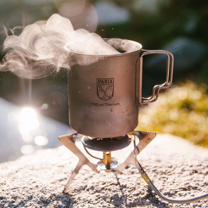
Titanium cooking pots are great for any backpacking trail. They're ultralight, but extremely durable.
If there's anything else you need to complete your pack, visit our full line of high-quality, affordable backpacking gear.
Shop Backpacking Tents
Shop Ultralight Tarps
Shop Backpacking Quilts
Shop Down Sleeping Bags
Shop Insulated Sleeping Pads
Shop Backpacking Pillow
Shop Folding Trekking Poles
Shop Titanium Cookware
Shop Tent and Tarp Accessories
Finally, to make sure you don't forget something at home, use our Ultimate Backpacker's Packing List. It even includes a convenient printable checklist!
Do I Need a Permit?
You do not need a permit or to reserve campsites.
Resources
USDA Page
Detailed Recreation Guide
Conclusion
If you're looking for a challenging trail for a weekend that is worth the views, check out the Eagle Rock Loop in western Arkansas.
Have you completed this or any other trail in the Ouachita National Forest? We'd love to hear about your experience in the comments section below!
Read Next
If you're looking for more hike ideas, read our “Best Backpacking Trips in the Midwest” round-up post. Also, the following Hike of the Week articles cover other great trails in the region.
Hike of the Week: Lake Ouachita Vista Trail
Hike of the Week: Ozark Highlands Trail
Hike of the Week: Lusk Creek Wilderness to Garden of the Gods (Illinois)
For even more amazing backpacking trips visit The Trailhead, our interactive hike map. It contains a curated list of dozens of hikes, each with a detailed write-up like this one.

Finally, check out our comprehensive list of backpacking articles that cover just about everything there is to know about backpacking. If you're just starting out, our Backpacking 101 section covers all the basics. If you already have a few trips under your belt, you can find more advanced topics covered in our Expert Articles.


Leave a comment