
Welcome to Paria's “Hike of the Week” series. These posts highlight one of the best trails from around the U.S. (and sometimes beyond). Reading about a great hike is nice, but we hope this series inspires you to get out and see these trails for yourself!
This week's focus is on the Black Elk Wilderness Loop in South Dakota.
Featured Photo: Cathedral Spires (photo by Ben Cappellacci)
Why This Hike?
South Dakota. Most people probably think of open prairies. That's not wrong. But, the western part of the state is a whole different world!
This area is known for the Badlands and Black Hills. Visitors are often surprised by how awesome the scenery is here. The picturesque landscape is filled with rolling pine and spruce-covered hills. The terrain is also dotted with serene lakes and streams. (You can find some waterfalls here and there too.) Another highlight is the unique rock formations in the region. All of this combined creates a mesmerizing landscape soon to become a favorite.
- Length: 27.5 miles
- Type: Loop
- Difficulty: Medium to strenuous (Most areas of the trail have moderate elevation gain. But, there are some steeper climbs in sections, like Black Elk Peak.)
- Best time to visit: May-October
- Black Elk Peak, formerly known as Harney Peak, is the tallest point between the Rockies and the Alps. You can see 4 different states from the peak!
- Between the gold rush in the late 1800s and the sacredness of the land to the local indigenous tribes, the area is rich in cultural history.
- The area is a stone's throw away from the Badlands. Perfect if you're looking for more epic backpacking opportunities.
- This route begins and ends in Custer State Park (known for its large bison herd). You can also find Wind Cave National Park, Jewel Cave National Monument, and a slew of other national monuments and memorials nearby.
- Wildlife diversity includes mule deer, elk, bighorn sheep, turkey, cougars, and a wide variety of birds of prey.
- The Black Elk Wilderness is the only wilderness area in all of Black Hills National Forest (1.2 million acres).
- Various trailheads are available along the route. The trail network allows you to shorten or lengthen your trip too.
- Sylvan Lake is a popular area within Custer State Park. Spend an extra night at the modern campground nearby or “rough it” closer to the lake.
- Look forward to fabulous sights each day of your trip.
Before you pack your bags, keep the following in mind:
- Strong thunderstorms are common on summer afternoons.
- Camping is not allowed within ¼ mile of Black Elk Peak.
- There is poor trail signage in some areas. Be sure to have a reliable and accurate map!
- Campfires are not allowed.
- There are many down trees in areas due to a pine beetle specific to the area.
How Do I Get There?
If flying in, Rapid City Regional Airport is the closest to the Sylvan Lake Trailhead. From there, take Airport Road and merge onto SD 44 W. Continue for 5.4 miles before turning left onto US 16 W. Continue for 5.8 miles. Turn left onto US-16 W/Mt Rushmore Rd and continue 18.6 miles. Turn left to stay on US-16 W and continue another 3.6 miles. Turn left and stay on Railroad Ave for another half-mile. Turn left again to stay on US-16 W and continue 13.3 more miles. Turn left onto Montgomery St for one mile. Then, turn left onto SD-89 N. Continue 5.4 miles. Turn right onto SD-87 S shortly followed by a left turn that passes the lake and leads to the parking area.
Map of Recommended Route
The following map outlines our recommended route. Click the "Load Interactive Map" button to load the correct map. Once loaded, you can navigate along the route and view recommended campsites.
For even more detailed mapping, including being able to print a copy for yourself, click the "Open in CalTopo" button at the top of the map once it's loaded into view.
- Day 1 - Sylvan Lake Trailhead to Grizzly Bear Creek (11.5 miles)
- Day 2 - Grizzly Bear Creek to Campsite 2 (9 miles)
- Day 3 - Campsite 2 to Sylvan Lake Trailhead (7 miles)
Trail Description
Since this is a loop, you can take either direction. Most hikers agree that counter-clockwise is the easier way to go. That said, the description below follows that direction from the trailhead.
Day 1 - Sylvan Lake Trailhead to Grizzly Bear Creek
Your first day starts with a bang. After a short, but uphill hike, you'll reach the spur trail to Little Devil's Tower. It's about a half-mile off the main trail, but well worth the view. If you're feeling adventurous (and steady), you can climb to the top. You can see Black Elk Peak in the distance, a highlight you'll see up close on your last day.
A short 0.2 miles back on the main trail brings you to the Cathedral Spires spur. It's about the same distance off of the main trail to get there. These unique rock formations are also awe-inspiring. They almost look out of place jutting up from the surrounding terrain.
After these two stops, you can look forward to much fewer crowds. You'll be leaving Custer SP and entering the Wilderness area. The Grizzly Bear Creek Trail is a quiet, remote area. You'll have plenty of opportunities to fill up on water too. Take your time as the trail is rather steep.
After heading south on the Grizzly Bear Creek Trail for a little over a mile, you can take a shortcut trail that leads to the Centennial Trail. Enjoy the ponderosa pine forest through here. Make a left and head north on the Centennial. You'll get your first glimpse of Mount Rushmore. Another 1.5 miles will bring you to your creekside campsite for the night.
Day 2 - Grizzly Bear Creek to Campsite 2
Be sure to fill up on water from the creek before setting out. After a very short distance, you'll find the spur trail that takes you to the Mount Rushmore parking area. You can take pictures from here and head on your way. Or, get a closer look by going into the actual park. You can splurge and get a meal and ice cream from the shops and use a real restroom.
After getting back on the Centennial Trail, continue heading northwest. The views along this section are amazing. Openings lead to great photo ops of the surrounding forest and rock formations this area is known for.
Note: Instead of taking the road (SD 244) as shown on our map, you may be able to take Trail 5 (Willow Creek Rushmore Trail) to head west if it is not closed for logging. Be sure to check the Forest Service page before your trip.
Water can be a bit tricky to find this day. There should be a seasonal creek near campsite 2. Depending on the time of year, you may still want to fill up at the creek that crosses trail 5 and under SD 244.
Day 3 - Campsite 2 to Sylvan Lake Trailhead
Soak up more great views on your last day. The Harney Trail follows a ridgeline for several miles, offering more great photo ops. About 3 ½ miles from your campsite, you'll reach the spur to Black Elk Peak. It's a short 0.2 miles, so don't pass it up. The views are amazing and one of the favorite stops of anyone who has visited the area. The old stone fire tower, built by the CCC in the 1930s, still stands proudly at the top.
The rest of your hike will be downhill. You'll also start running into more and more hikers as you get closer to civilization. Stay on the Harney Peak Trail and you'll be back to the parking area at Sylvan Lake a few short miles later.
What Will I Need?
Average highs May through October range between 61° and 86°F. Average lows range between 43° and 66°F. A quality down quilt or sleeping bag should keep you plenty warm at night. Of course, your sleeping pad plays a big role in your warmth at night too. So don't skimp on it either!
The weather can change quickly in the summer months. Make sure to bring a backpacking tent that will hold up and protect you from the wind and rain.
No open fires are allowed in the wilderness area. This means your backcountry stove and cooking pot will be your best friends on this trip. Don't forget a long-handled spork for any dehydrated bag meals.
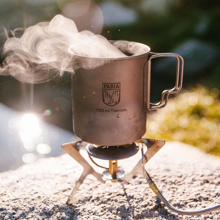
Titanium cooking pots are great for backpacking. They're ultralight, saving on pack weight on the Black Elk Wilderness Loop, without skimping on durability.
If there's anything else you need to complete your pack, visit our full line of high-quality, affordable backpacking gear.
Shop Backpacking Tents
Shop Ultralight Tarps
Shop Backpacking Quilts
Shop Down Sleeping Bags
Shop Insulated Sleeping Pads
Shop Backpacking Pillow
Shop Folding Trekking Poles
Shop Titanium Cookware
Shop Tent and Tarp Accessories
Finally, to make sure you don't forget something at home, use our Ultimate Backpacker's Packing List. It even includes a convenient printable checklist!
Do I Need a Permit?
Free permits are available at kiosks near trailheads.
Resources
Forest Service Info-Black Elk Wilderness
Conclusion
If you're looking for a hidden gem trip that offers unique scenery, don't pass up the Black Elk Wilderness Loop in South Dakota.
Have you completed this trail or any others near the Black Hills Forest? We'd love to hear about your experience in the comments section below!
Read Next
If you're looking for more hike ideas, read our "Best Backpacking Trips in the Midwest" round-up post. Also, the following Hike of the Week articles cover other great trails in the region.
Hike of the Week: The Beaten Path
Hike of the Week: Titcomb Basin
Hike of the Week: Continental Divide Loop
For even more amazing backpacking trips, visit The Trailhead, our interactive hike map. It contains a curated list of dozens of hikes, each with a detailed write-up like this one.

Finally, check out our comprehensive list of backpacking articles that cover just about everything there is to know about backpacking. If you're just starting out, our Backpacking 101 section covers all the basics. If you already have a few trips under your belt, you can find more advanced topics covered in our Expert Articles.


Leave a comment