
Welcome to Paria's “Hike of the Week” series. Each week, we share one of the best backpacking trails from around the U.S. and Canada. It inspires us to see pictures of and read about great trails. We hope this series does the same for you!
This week we're highlighting the Alice-Toxaway Loop in central Idaho.
Featured Photo: Toxaway Lake Sunrise (photo by Troy Smith)
Why This Hike?
This loop trail is located in Idaho's Sawtooth Wilderness. This area is arguably one of the most scenic in the state. Jagged, granite peaks rise all around. Alpine lakes reflect these mountains in their calm waters. Even with the rugged landscape, the elevation gain isn't horrible. The Alice-Toxaway Loop could be done as an overnight or one long day hike. But, you'll want to spend more time if you have it.
- Distance: 19 miles
- Difficulty: Moderate to difficult
- Elevation gain: 3,285 feet
- Best time to visit: July through September
- The chance to spend the night next to a lake each night
- Short hiking days to really enjoy the scenery and explore more at your leisure
- Several side trip options on the second day if Snowyside Pass doesn't wind you
- Better and better views as you summit Snowyside Pass
- Other natural features: Conifer forests (lodgepole and Douglas fir) and open meadows
- Wildlife: Black bear, mountain goats, elk, moose, wolves, mountain lions, deer
- Toxaway Lake is reportedly good for fishing
- Plenty of lakes and streams to fill up on water
- Pettit Lake Campground is an option to stay at the night before or after your trip. It's located near the trailhead.
Before you pack your bags, keep the following in mind:
- Fires are not allowed at the lakes.
- Bugs are bad in the summer, especially around the lakes.
- Bring a bear canister to keep the marmots and pika out of your food.
- Afternoon thunderstorms are common in the summer months.
How Do I Get There?
If you are flying in, the closest major airport is the Boise Air Terminal. From here, head onto I-84 E. Take exit 57 after 3 miles. Turn left onto ID-21 N and continue for 126 miles. Turn right onto State Highway 75 S and continue for 18 miles. Turn right onto US Forest Road 208. Continue 1.6 miles before turning right onto Forest Road 362. Turn left less than a mile later to stay on this road for another half-mile. Parking is along the loop at the end of this road. Drive time is a little over 3 hours. Total distance from the airport is 150 miles.
Map of Recommended Route
The following map outlines our recommended route. Click the "Load Interactive Map" button to load the correct map. Once loaded, you can navigate along the route and view recommended campsites.
For even more detailed mapping, including being able to print a copy for yourself, click the "Open in CalTopo" button at the top of the map once it's loaded into view.
- Day 1 - Tin Cup Trailhead to Twin Lakes (7 miles)
- Day 2 - Twin Lakes to Toxaway Lake (5 miles)
- Day 3 - Toxaway Lake to Tin Cup Trailhead (7 miles)
Trail Description
Day 1 - Tin Cup Trailhead to Twin Lakes
Want to get the majority of your climbing out of the way while you're still fresh? Take the trail clockwise. Your hike starts with great views of McDonald Peak reflected in Pettit Lake. Past here, the trail alternates between forest and sprawling meadows. Lots of creek crossings line the way too. Elevation gain is gradual as the views of the Sawtooth Mountains get better and better.
Alice Lake is a picturesque spot to spend the night. For more seclusion, head a little further. There is a spur trail between the Twin Lakes. It's only about .3 miles off the main trail to great camping spots. Enjoy views of the stars and the craggy peaks rising behind the lakes.
Day 2 - Twin Lakes to Toxaway Lake
Get ready for more uphill hiking to cross Snowyside Pass. It's mostly all downhill after this. Lingering snow isn't out of the question up here. (Even in the summer months.) Views open up more on your climb. You'll come across a series of switchbacks on the other side of the pass. Pass by three small ponds. You'll reach Toxaway Lake before long on this short day. Lots of good campsites dot the wooded shore.
Day 3 - Toxaway Lake to Tin Cup Trailhead
Enjoy almost all downhill hiking on your last day. Pass by several more small ponds. Travel is next to a creek for much of the way, so no worries about running low on water. There are excellent views of the Sawtooth and White Cloud Mountains at the beginning of your descent.
If you have time to spare, take the side trail to Edith Lake. Otherwise, cross its outlet towards Farley Lake. The trail heads back into the woods after Farley Lake. If you're not quite ready to leave, make a side trip to McDonald or Yellow Belly Lake.
What Will I Need?
July-September average highs are 66-76°F; average lows 44-54°F. It can get quite chilly at night in the mountains here. A down sleeping bag paired with an ultralight sleeping pad will keep you warm. Your sleep system is most important for sleep comfort. But, a durable backpacking tent will help protect you from the elements too.
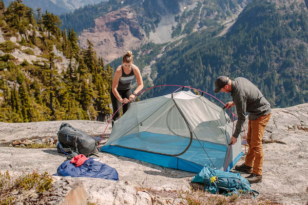
The Zion 2P Backpacking Tent makes a great 2-person shelter to protect you from the elements of the Sawtooth Mountains.
Make your downtime more comfortable with an inflatable sit pad. A titanium mug is also nice for warm drinks to warm your bones in the morning.
Don't forget your bear bag or canister too! Pika lose their cuteness factor when they break into your food overnight.
If there's anything else you need to complete your pack, visit our full line of high-quality, affordable backpacking gear.
Shop Backpacking Tents
Shop Ultralight Tarps
Shop Backpacking Quilts
Shop Down Sleeping Bags
Shop Insulated Sleeping Pads
Shop Backpacking Pillow
Shop Folding Trekking Poles
Shop Titanium Cookware
Shop Tent and Tarp Accessories
Finally, to make sure you don't forget something at home, use our Ultimate Backpacker's Packing List. It even includes a convenient printable checklist!
Do I Need a Permit?
Yes, but they are free and self-register. You will find the kiosk for these near the trailhead.
Resources
Conclusion
If you're looking for a laid-back trip to enjoy the Sawtooth Mountains, you can't beat the Alice-Toxaway Loop. Have you hiked in this area? We'd love to hear about your experience in the comments below!
Read Next
If you're looking for more hike ideas, read our "Best West Coast Mountain Backpacking Trips" round-up post. Also, the following Hike of the Week articles cover other great trails in the region.
Hike of the Week: Glacier North Circle
Hike of the Week: Teton Crest Trail
Hike of the Week: The Beaten Path
For even more amazing backpacking trips, visit The Trailhead, our interactive hike map. It contains a curated list of dozens of hikes, each with a detailed write-up like this one.

Finally, check out our comprehensive list of backpacking articles that cover just about everything there is to know about backpacking. If you're just starting out, our Backpacking 101 section covers all the basics. If you already have a few trips under your belt, you can find more advanced topics covered in our Expert Articles.


Leave a comment